Polstraat, Aalten (no longer extant)
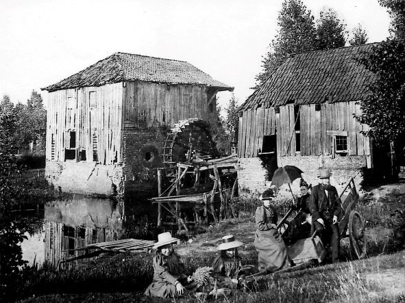
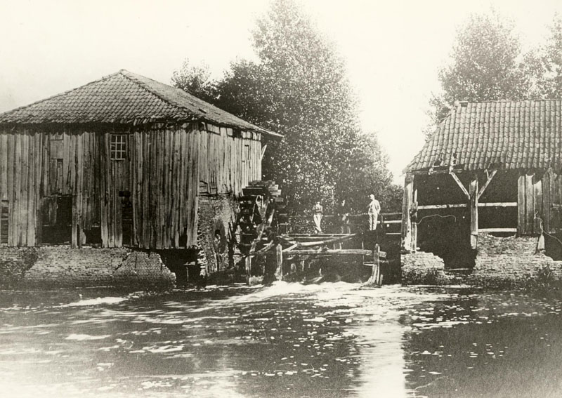
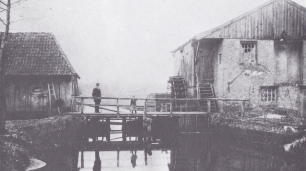
For centuries, a watermill stood on the Slingebeek stream near the De Ahof manor, approximately at the location of the current stone bench erected by Aaltens Belang. At the beginning of the 20th century, the dilapidated mill was demolished. The mill featured wheels on both sides of the stream: on the south bank stood the oil mill (with a wheel of 4.42 m Ø) and on the north bank was the bark mill (with a wheel of 4.66 m Ø), with the corn mill situated above it.
The watermill was likely built shortly after 1500, possibly due to a transfer of manorial milling rights from the Grevinkhof in Dale to De Ahof, which later also came into the possession of the Grevink family. The first mentions of the mill date from 1502, including records concerning income for the steward.
In 1562, the mill was described as a ruin, yet it repeatedly appears in the archives in later years. B.D. Rots writes in his book ‘Aalten en Bredevoort in vervlogen tijden’ that around 1700, the watermill was owned by the House of Orange, who leased it to a miller. On 9 February 1707, De Ahof, along with “the hereditary lease of the Aalten Watermill”, passed into the hands of the Arentsen/Arentzen family.
In 1739, the owners Bernardus Arentzen and Gerrit Jan Heusinkveld complained about competition from the numerous horse mills around Aalten, while they constantly incurred costs to keep the watermill in good repair. In 1758, it is noted that the city council of Bredevoort had the right, in the event of flooding, to raise the sluice gates at De Ahof and take them to their city.
Around 1830, the corn mill had two undershot wheels and three sets of millstones, while the oil mill had one wheel and three stampers. During water shortages, the mills could also be driven by horses. Although the mill had three undershot wheels, a small overshot wheel with a separate leat could be deployed for the corn mill during low water levels from 1840 onwards.
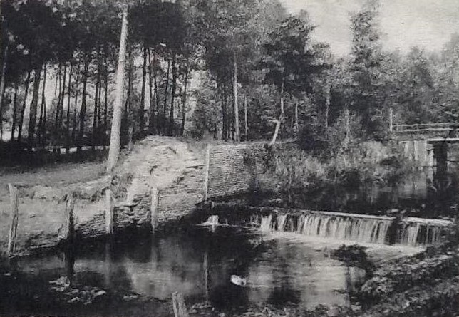
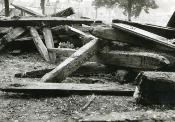
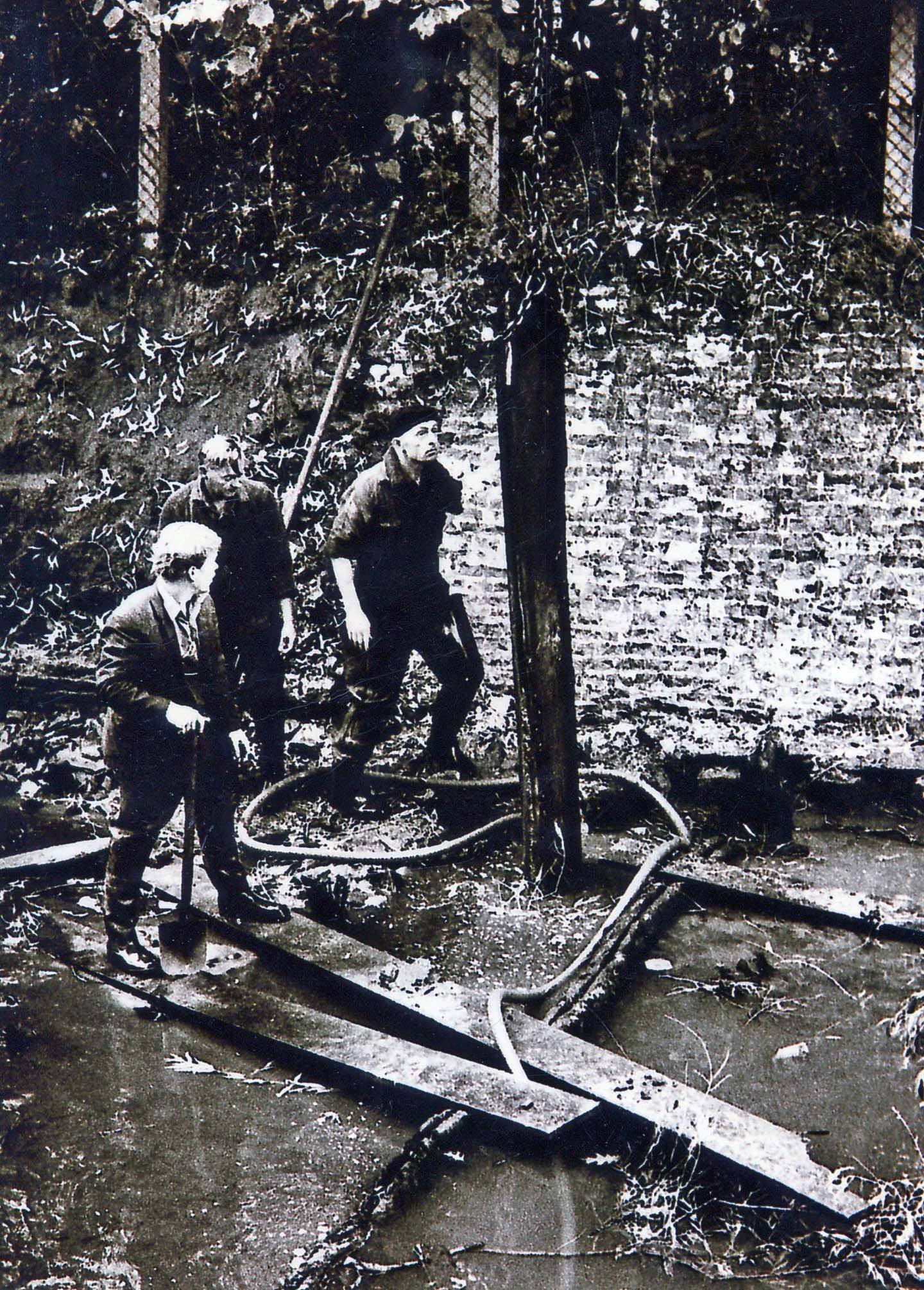
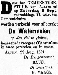
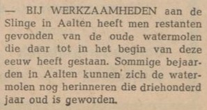
The mill finally disappeared around 1900; only the wheel of the corn mill remained at that time. Photographs from that era show that the entire complex had fallen into decay. During works on the Slinge in 1969, approximately 200 foundation piles were removed. Today, only a remnant of a wall serves as a reminder of the watermill.
Owners
Overview is incomplete.
| Year | Plot | Owner | Description |
|---|---|---|---|
| 1832 | I-182 I-228 | Roelof Arentzen, assessor | 470 m² mill & yard 920 m² mill & yard |
| 1851 | I-182 I-228 | Engelbarta Hendrica Arendsen and Gezina Arendsen, widow of J.W. te Gussinklo | 470 m² mill & yard 920 m² mill & yard |
| 1854 | I-1918 I-1968 | Engelbarta Hendrica Arendsen and Gezina Arendsen, widow of J.W. te Gussinklo | 470 m² grain mill & yard 178 m² mill & yard |
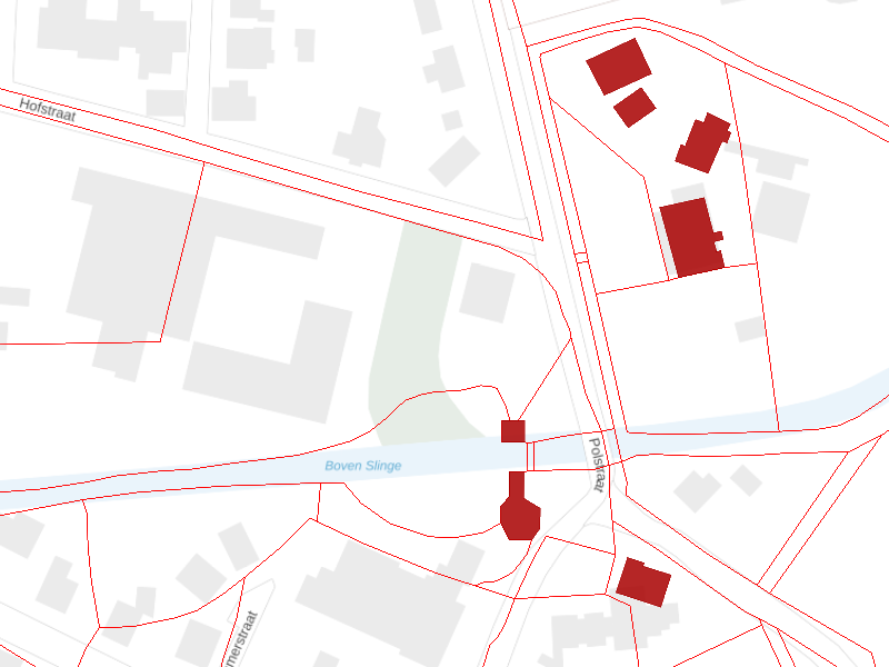
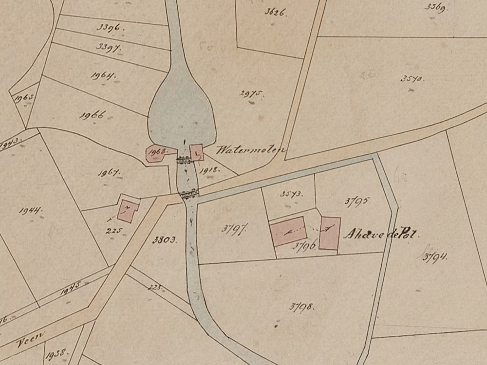
Location of the watermill, with De Ahof at the top right. All red buildings on this map were, according to 1832 land registry data, owned by Roelof Arentzen, assessor in Aalten. The red lines represent the plot boundaries at the time, which also clearly show the course of the former moat around De Ahof.
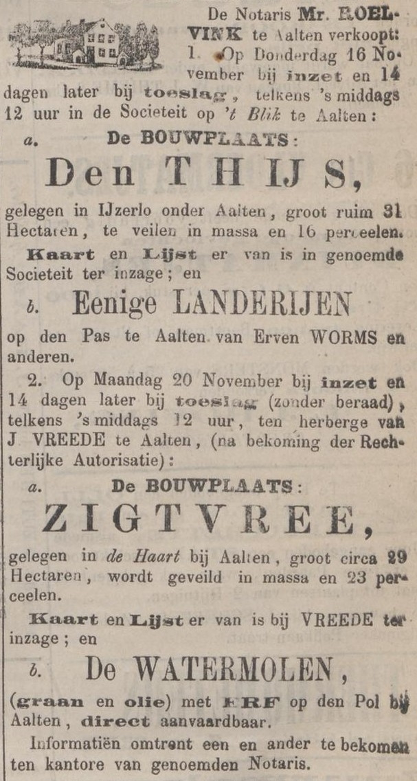
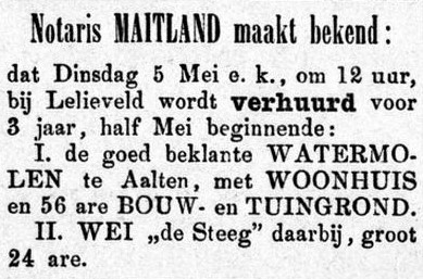
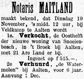
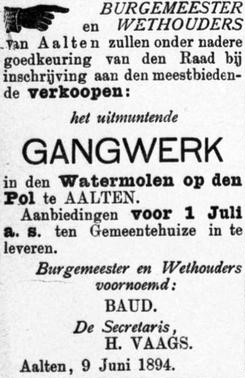
Newspaper reports
Features
| Cadastral no. | I-12213/8533 |
| Function | Watermill |
| Year of construction | c. 1500 |
| Demolition | c. 1900 |
Sources
- Address directory Aalten (1934 & 1967)
- Delpher
- ECAL
- HisGIS
- Land Registry
- Cadastral map
- ‘Molens, Mulders, Meesters’, Hagens. Verzameling H. van der Kaay.
- molendatabase.org