Kloosterdijk, Aalten
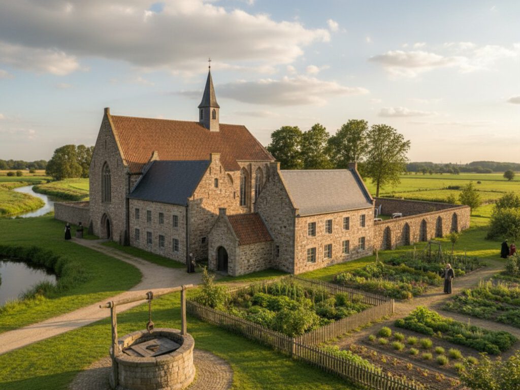
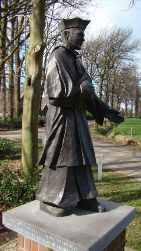
Schaer Monastery was a monastic house near Bredevoort, founded in 1429 and belonging to the order of the Modern Devotion. It was located in the hamlet of ’t Klooster, approximately two kilometres north of Bredevoort, on the left bank of the Schaarsbeek.
The pious nobleman Derck van Lintelo and Conraedt Slindewater, clerk to the Drost of Zutphen and originating from a prominent patrician family from the Hanseatic city, donated land and farms in 1429 to displaced monks from Windesheim, near Zwolle.
The Windesheimers belonged to the late-medieval movement of the Modern Devotion, which had emerged under the leadership of Geert Grote (1340–1384) in Deventer. From the IJssel cities, this reform movement spread across Western Europe and led to the founding of more than a hundred monasteries. The Modern Devotion strove for the renewal of church and society, forming a transition between the Middle Ages and the early modern period.
Foundation
The Windesheimers preferred to settle in remote locations. The donation of land near the Schaersvoorde—in the current hamlet of ’t Klooster—in 1429 fitted this preference well. It was a high-lying area on the edge of the vast Schaersheide, bordering the low-lying and marshy Bredevoortse Broek. Using the clay present just below the surface, the monks baked their own ‘kloostermoppen’ (monastic bricks).
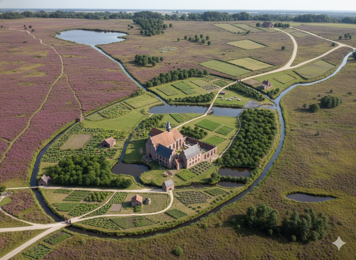
The monastery, Domus Beatae Mariae in Nazareth (House of the Blessed Mary in Nazareth), rose shortly thereafter. It was popularly known as Schaer Monastery, named after the heath on which it was situated. The residents were soon actively involved in the care of young students and the improvement of the living conditions of the local population.
Prayer and work defined daily life for the Windesheimers. Through diligent labour, the monks managed to reclaim the immediate surroundings of the monastery. By 1500, it was a fertile, egg-shaped oasis in the wilderness, with Nazareth as its centre, surrounded by an outer moat.
In 1522, several improvements were made. The monastery’s clockwork and chiming bell were transferred to the Saint George’s Church in Bredevoort in 1596—where the bell still hangs today.
Legend and Gold Treasure
In 1597, when the army of Prince Maurice was on its way to Bredevoort, the last prior of Schaer Monastery fled. The remaining monks also found it safer to seek refuge elsewhere. Shortly thereafter, the abandoned monastery was destroyed by marauding soldiers.
Since then, the story has circulated that the fleeing monks hid a treasure in the ground—under the third holly bush behind the sheepfold. However, no one remembers exactly where that sheepfold once stood. According to legend, the treasure will one day be found again, indicated by ‘heavenly signs’: a strange light will appear in the sky until a black rooster crows.
On the night of 13 to 14 September 1943, an unusual light was indeed observed: a moonbow. There were many bombers in the air that night, meaning many people were awake to witness this rare phenomenon. Whether a black rooster also crowed that night is unknown.
Size
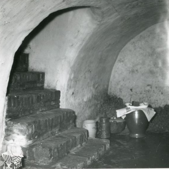
Field and archival research shows that Schaer Monastery was of modest size. The perimeter of the monastery grounds is easily traceable: field names are still recognisable, and remains can be found on a farmyard. At the beginning of the twentieth century, a crucifix and a skull were discovered during excavation work. Furthermore, the so-called Kloosterschans (Monastery Redoubt) is still located on the site. In 1978, the last above-ground wall remains were demolished, but a monastery cellar with a barrel vault still exists beneath the local farmhouse.
The oval monastery area—also called the corpus—covered approximately 118 hectares and showed a height difference of over ten metres from west to east. The monks made optimal use of the relief, the water, and the soil conditions. Seepage and rainwater, as well as water flowing from the high Schaerheide, moved just below the surface over impermeable clay layers towards the Bredevoortse Broek. The monks threw up a dyke straight through the area to dam the water and utilise it to power a corn and oil mill.
With a system of interconnected waterways and ponds, the monks kept their feet dry and prevented the water from flowing unused into the low marshlands. On the east side of the monastery complex, they created a remarkable piece of earthwork: the Eremus in Aquis—literally ‘the wilderness in the waters’—a hermitage on the edge of the marshy Bredevoortse Broek. The moats around this hermitage served as water storage.
Remains
After the destruction of the monastery in 1597, the lands became overgrown with heath and coppice. The monastic bricks from the complex were partly reused for the repair of fortifications and houses in Bredevoort. The monastery’s possessions were confiscated by the Duchy of Guelders. The Eremus in Aquis may have been used as a redoubt during military operations around Bredevoort in later years. In 1672, the west wing of the rectangular monastery complex was still standing.
With the seizure of the monastery area, the landscape took on a second historical layer: the planting of timber plantations. Guelders leased the lands for the production of oak wood. Around 1700, work began on the necessary drainage. Straight channels drained water quickly into the Schaarsbeek, and the same stream—once part of the outer moat—was straightened towards Bredevoort to supply the town’s moats with water. The waterways near the Eremus in Aquis silted up, and so-called rabatten (narrow raised beds) were laid out on the former monastery grounds to plant young oaks.
Due to several very harsh winters, the first plantings failed. Guelders then decided to sell the monastery area. The new owners continued the forestry following the same system of rabatten and drainage. The current 25-hectare Kloosterbos (Monastery Forest) still preserves the traces of the late-medieval water management system once laid out by the monks of Schaer.
Archives
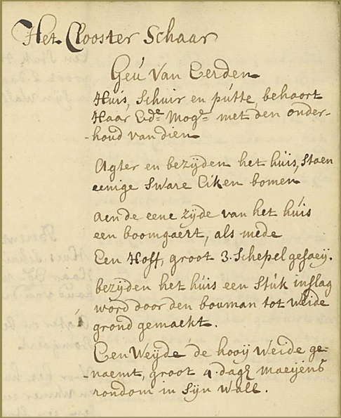
Verpondingskohier (tax register), 1647
t’Clooster te Schaer en sijn becirck?, Geestl.
2 Huisen, met etlicke koolhoven, 3 sch.
Boulant 27 mdr., 3de gerve 225 – 0 -.
Inslagh en hoeijmate van 4 daghen meijens, slechten waterigen gront.
Features
| Function | Monastery |
| Foundation | 1429 |
| Destruction | 1597 |
Sources
- ‘Breevoort can ick vergeten niet’, H.A. Hauer
- Het Kloosterbos
- Kloosters Belang
- Verpondingskohier 1647-1650
- Wikipedia
- Windesheimers op de heide, Hans de Graaf